All our Churches are ancient and have been a permanent part of the landscape for hundreds of years.
Even before they were built, there was very often a religous site where our villages lie and, over the years, they can be seen in the maps of the times.
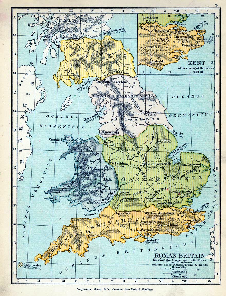 The story starts with the Roman map of Britain in about 400 AD. and there is evidence of Roman Villas in Gayton Thorpe & Grimston and a Roman iron furnace in Ashwicken.
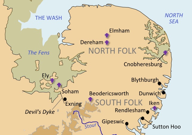
Below is a map of Anglo Saxon Britain in about 800 AD. when there was already a settlement at Bawsey. You can learn more about this on our Bawsey page.click here
Map is attributed to Amitchell125 at English Wikipedia.
The 1650 map of Wenceslas Holar.
The basic village structure has formed as shown in the map below with all our Churches, including the now ruined Churches of Bawsey, Mintlyn and Leziate.
Clicking on the map will bring up a larger more detailed map in a new window.
.jpg)
The map drawn by William Faden in 1797.
This shows our villages much as we know them even today.
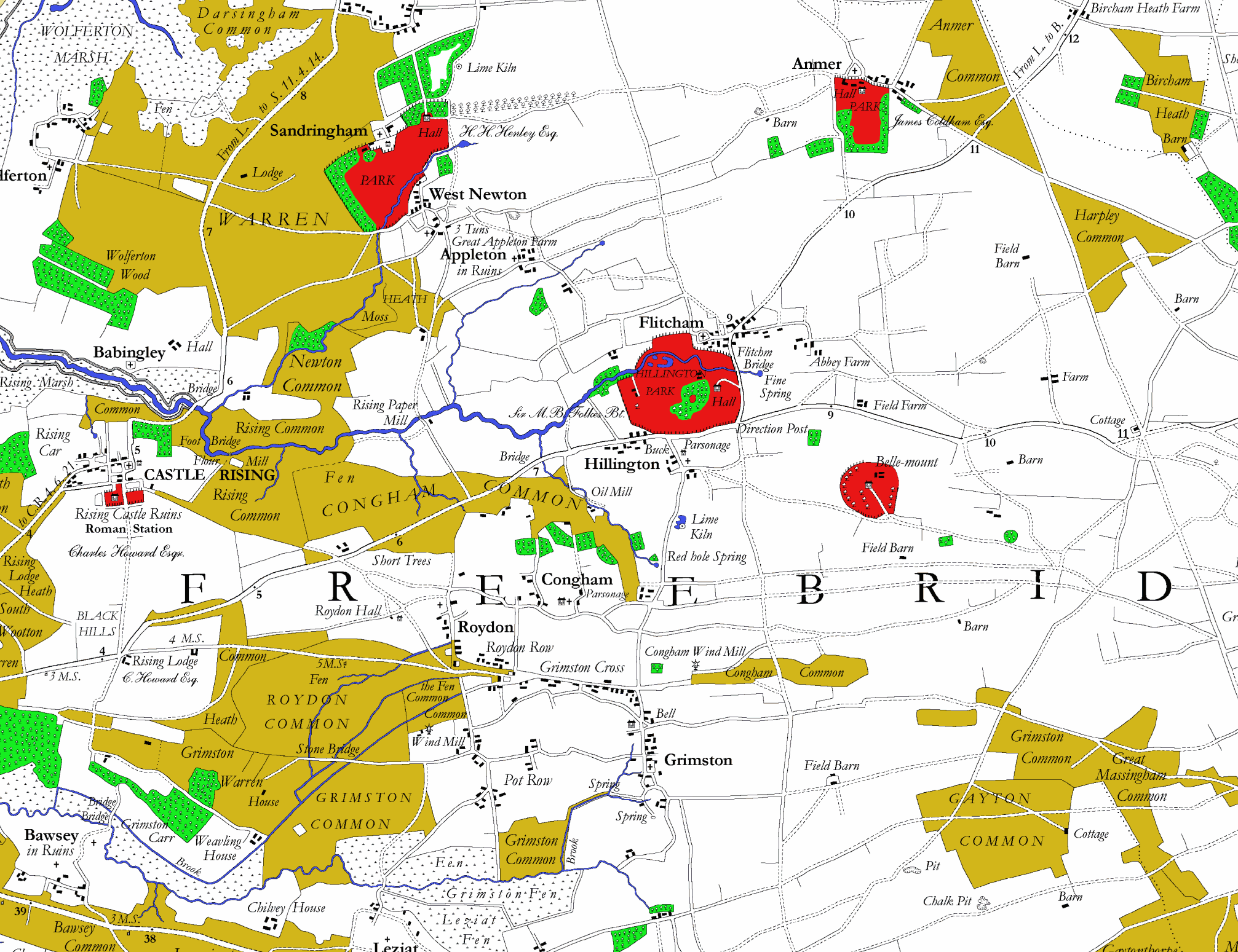
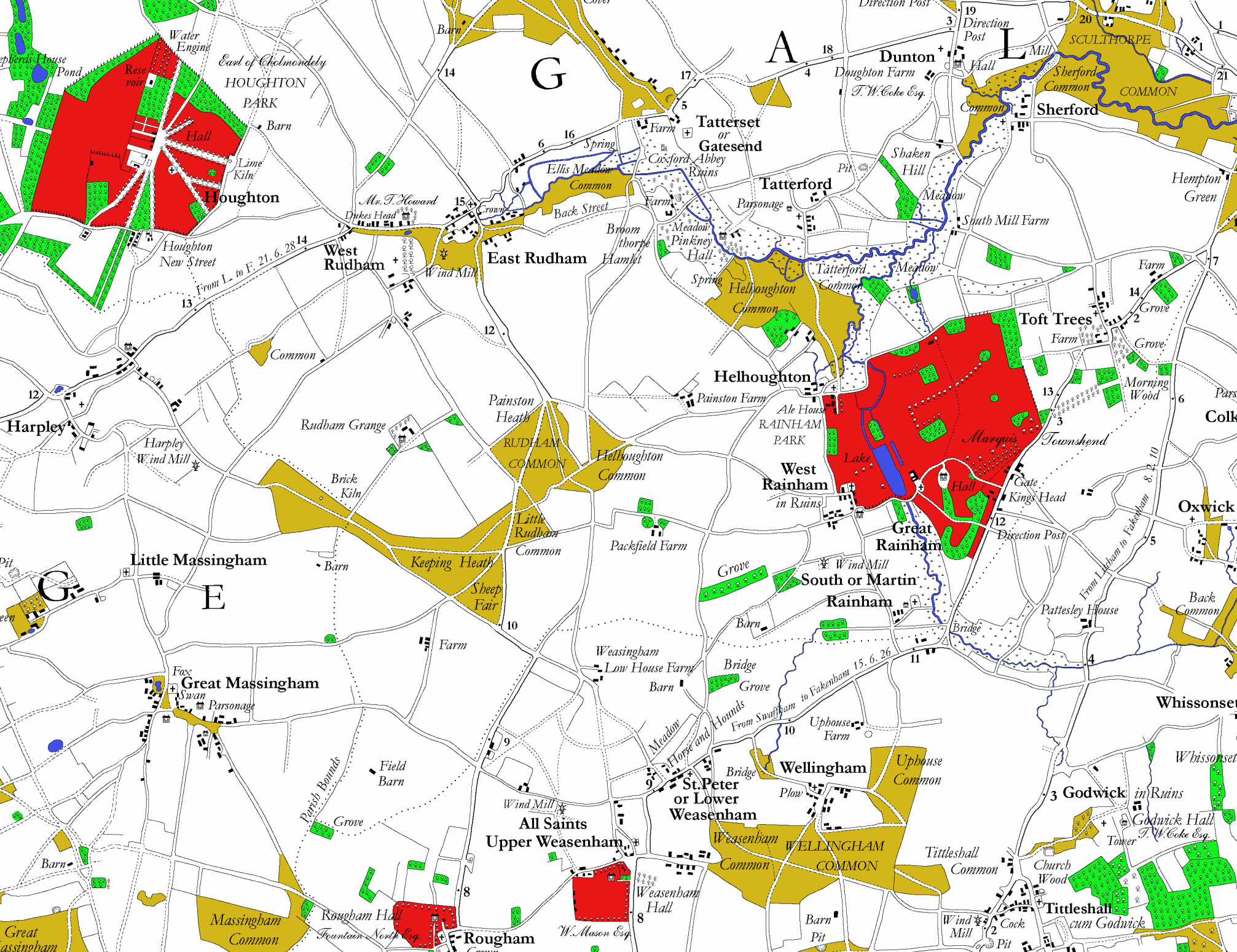
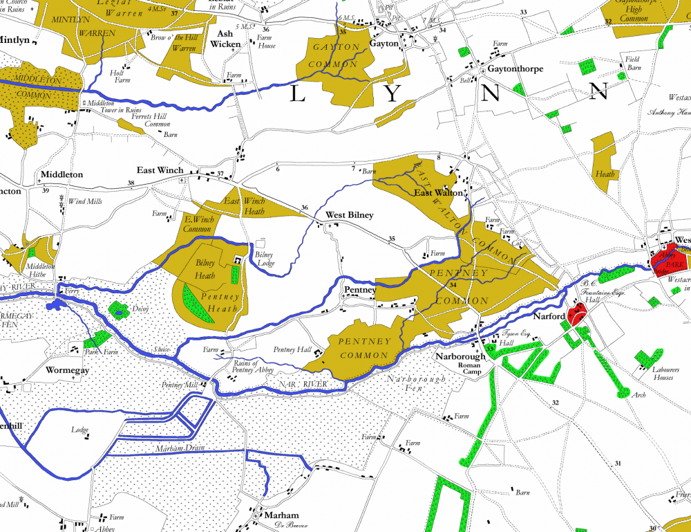
Click on the smaller maps below to see a much larger map of each quadrant.
 |
 |
 |
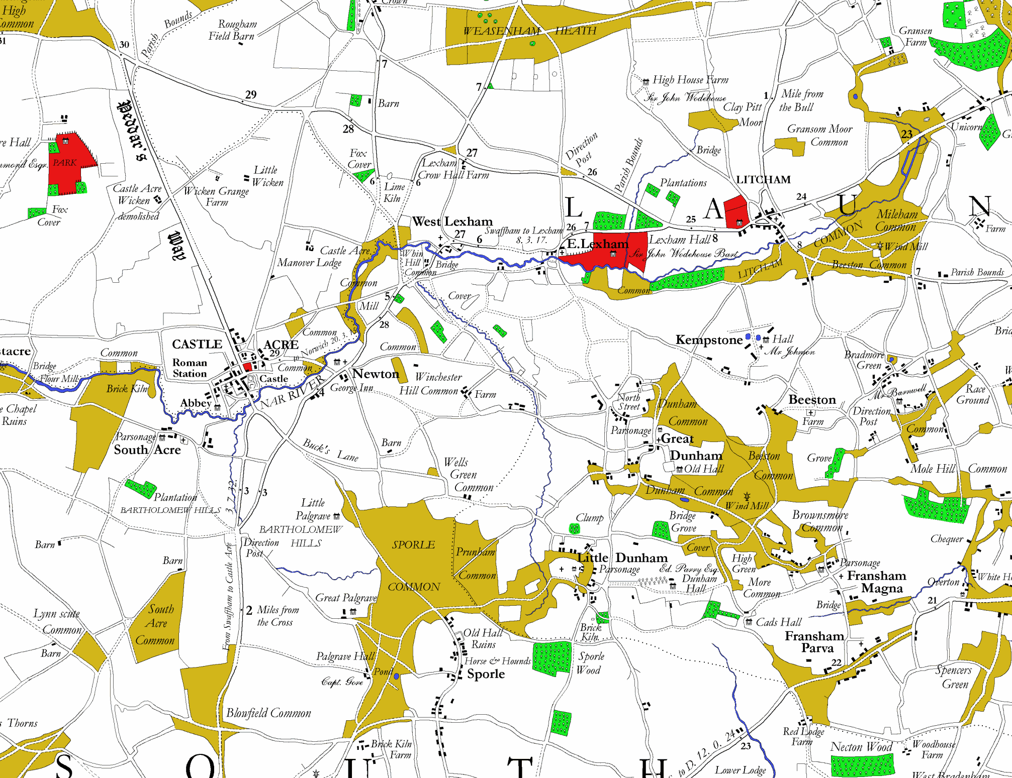 |
| North West Quadrant | North East Quadrant | South West Quadrant | South East Quadrant |
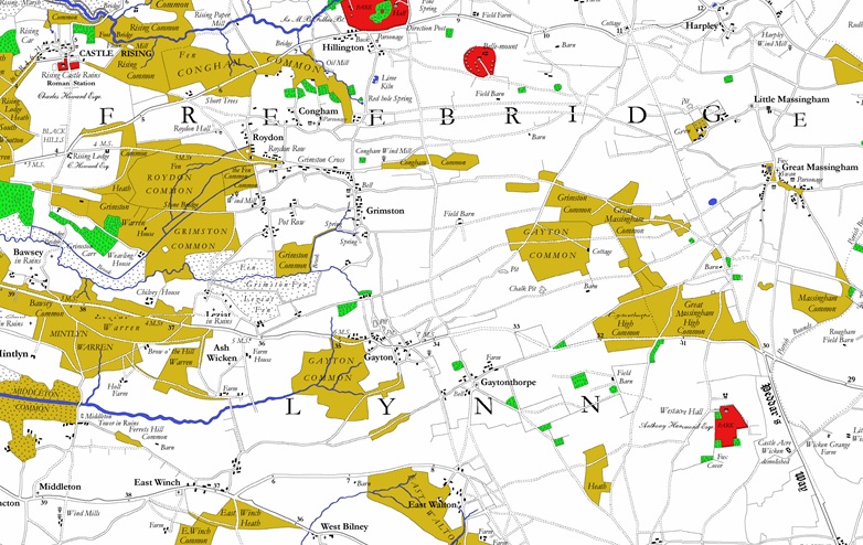
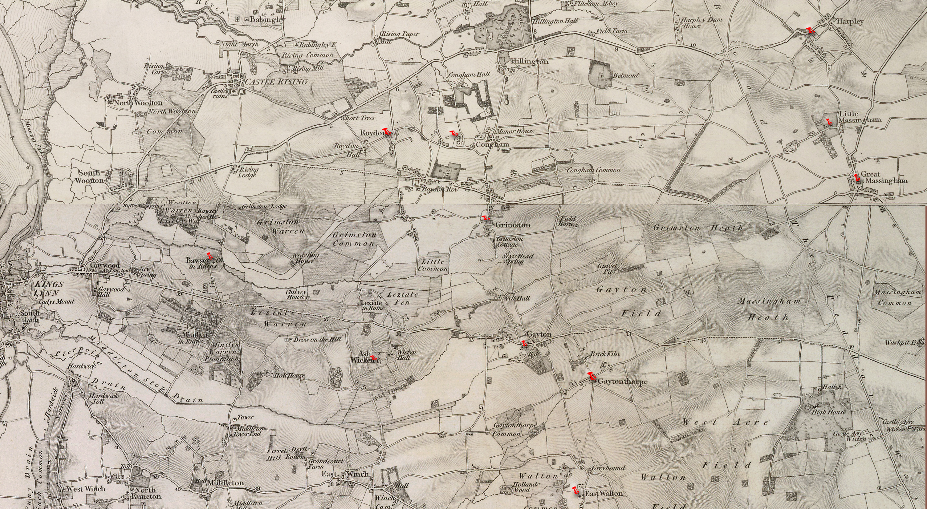
The map below is from the 1st Ordnance Survey mapping of 1824.
All our Churches are marked in red.
© Crown Copyright and Database Right [2015]. Ordnance Survey (Digimap Licence)
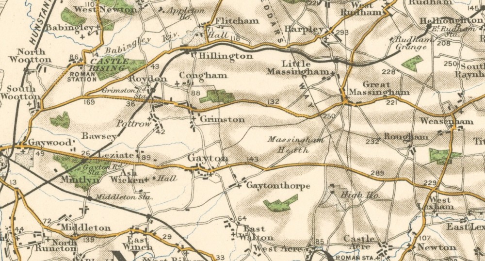
The Ordnance Survey map of 1905.
One Hundred years later, shows how the railways helped develop the countryside.
Now they are gone but they have left their mark.
Again if you click on the map, a new window will open showing a much larger map.